
What to know before your visit
Blue Bay’s coral gardens are living habitats with different coral growth forms, not a continuous carpet of colourful rock. A glass-bottom boat or snorkelling visit offers a way to look at their shapes and surrounding habitats. Colour alone cannot establish coral health, and historical descriptions are not reports of today’s conditions.
Understand the garden as a living habitat
The useful starting point is that coral formations are living habitats, not platforms to stand on. The historical wetland description of Blue Bay includes table and staghorn formations. These terms help you think about the garden’s structure before trying to identify individual coral species.
Corals also have a relationship with symbiotic algae, which they can lose under stress. That living relationship matters more than whether a formation looks impressive in a photograph. For your visit, try looking first at outlines, then at the arrangement of neighbouring patches, rather than searching only for the brightest colour.
Read historical records as background, not a current census
The 2008 Ramsar information sheet records Blue Bay Marine Park as covering 353 hectares in Grand Port, beside Blue Bay beach. It describes a site containing coral, seagrass, mangroves and macroalgae. That gives useful context: the coral gardens belong to a wider habitat mosaic, rather than representing everything within the park.
The date is important. This is a historical site record, not a measurement of present coral cover, visibility or abundance. Use it to understand why the area is significant, but not to predict how much living coral you will see on one outing. The route, light and water conditions all shape what you see during a visit.
Use growth forms to organise what you see
A growth form describes shape; a scientific name identifies a coral more specifically. Keeping those ideas separate makes a visit easier to interpret. The historical wetland description names Montipora aequituberculata and mentions table and staghorn formations, but it is not a current identification map.
| Historical reference | A useful observation task | What it does not establish |
|---|---|---|
| Table formations | Look for a flattened, spreading outline, and compare its shape with neighbouring formations. | A table-like outline alone does not identify a species or establish its health. |
| Staghorn formations | Look for an antler-like branching outline rather than judging only by colour. | The description does not promise that a particular viewing stop contains this form today. |
| Montipora aequituberculata | Treat this scientific name as part of the historical site record. | Its inclusion does not confirm that a coral in your photograph belongs to this species. |
Look at the spaces between coral patches
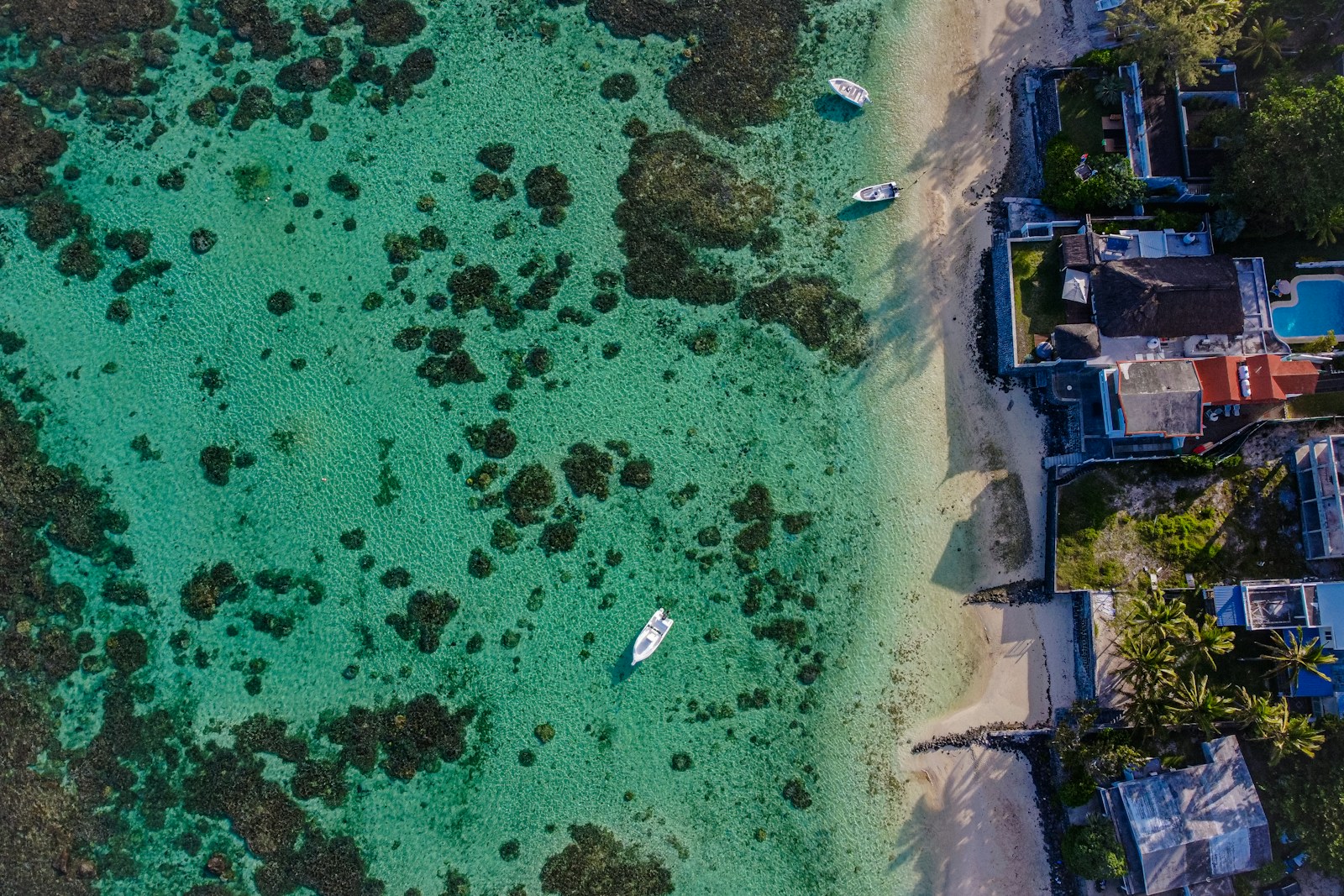
Think in patches rather than expecting one continuous coral carpet. As an observation exercise, try to distinguish coral formations, vegetated areas and sand in the view available to you. Avoid automatically labelling every green patch as seagrass or every pale patch as bleached coral.
The Ramsar record identifies feeding and nursery functions for seagrass and mangrove habitats. These are part of the park’s ecological context, not merely scenery around the coral. Do not expect one viewing stop to display every habitat in the record. Instead, notice where the visible scene changes from one kind of surface or structure to another.
Use sandy gaps as visual reference points: they can help you describe where one formation ends and another begins without needing a species name.
Coral colour alone cannot establish coral health
NOAA explains that heat and other stress can cause corals to lose their symbiotic algae and become pale or white. This is coral bleaching. Bleached coral is not automatically dead: recovery can occur if the stress eases. Equally, a colourful photograph should not be treated as a health assessment of the whole park.
Coral condition can vary between patches, so avoid drawing conclusions about the whole park from a single stop. If you notice a pale formation, record what you actually observed rather than diagnosing it. One visitor photograph cannot establish the condition of the wider reef.
Choose your viewing method around how you want to observe
For a glass-bottom visit, a useful aim is to follow the pattern beneath the viewing window. Compare outlines and the spaces between them, rather than trying to name everything as it passes. Before choosing an outing, ask whether its planned viewing stops focus on coral formations; do not assume every route offers the same view.
For snorkelling, make controlled observation the priority. If you cannot remain clear of coral without touching or standing, favour a boat-based view instead. When conditions and instructions allow, spend time observing one patch rather than continually chasing a different subject.
Neither method guarantees visibility, particular formations or a complete picture of the gardens. Choose a manageable way to look carefully, not a promise of seeing every feature mentioned in historical descriptions.
Use this checklist to keep the visit focused and gentle
A little preparation makes it easier to concentrate on the coral’s structure without using the habitat for support. Treat this as a practical observation checklist, alongside the park’s current instructions.
- Choose one observation goal, such as comparing growth forms or noticing transitions between coral and sand.
- Confirm where your activity is permitted before entering the water.
- For snorkelling, check your equipment before approaching coral so adjustments do not require standing on it.
- Keep hands, fins and equipment clear of formations; never use coral as a foothold.
- Do not feed marine animals or collect plants or animals.
- Take any rubbish away rather than leaving it on the boat, shore or in the water.
- When labelling photographs, separate observed shape and colour from uncertain species or health interpretations.
Follow current instructions when choosing where to look
The published 2001 marine protected area regulations provide a zoning framework, not a live access map. They distinguish swimming, traffic, mooring, conservation and strict conservation areas. Swimming, snorkelling and diving are prohibited in traffic lanes, so visible coral is not, by itself, a reason to enter the water there.
Nor does every strict conservation designation mean all viewing is excluded. Blue Bay strict conservation zone A specifically allows glass-bottom boats and boats transporting snorkellers or divers for those activities, subject to schedules the authority may set. Boats and commercial activity are governed by permits.
Follow current signs and park instructions. Do not turn an old zoning description, a photograph or an attractive patch of coral into your own navigation plan.
Plan your visit
Questions before you go
How many coral species have been recorded at Blue Bay?
The 2008 Ramsar information sheet records 38 coral species in 28 genera and 15 families. Those figures describe the historical record, not a current census or the number you should expect to recognise during a visit.
Can I stand on coral if I need a break?
No. Coral is a living habitat and must not be used as a platform. Agree on a suitable return and rest plan before entering the water, and choose a dry viewing trip if a snorkelling session does not fit your ability.
Can I understand the coral gardens from the beach?
Use a shoreline view for the lagoon setting, rather than treating it as a detailed coral survey. If your aim is to compare underwater formations, consider an authorised glass-bottom or snorkelling visit, without assuming particular visibility or access.
Do I need to snorkel to appreciate the coral gardens?
No. Glass-bottom viewing is an option recognised in the regulations for Blue Bay strict conservation zone A. It offers an alternative to entering the water; ask about the planned coral-viewing stops rather than assuming a specific route.
Can I identify Montipora aequituberculata from a holiday photograph?
Do not label a coral with that name merely because it appears in Blue Bay’s historical description. Unless you have a supported identification, retain the photograph with a plain description of the visible shape and location instead.